
Çukurova, historically and culturally significant in Anatolia, is a crucial region that has maintained its importance through various epochs. The eastern part of the Mediterranean Region, made up of Mountainous and Plains Cilicia, encompasses Çukurova today as it did historically, continuing to be a major center of attraction. The northern-northwestern boundary of Çukurova is marked by the Taurus mountain range, which separates it from the inner parts of Anatolia. The Amanos Mountain range (Nur Mountains) delineates the eastern boundary, setting Çukurova apart from Southeastern Anatolia and Northern Syria. The Mediterranean Sea defines the southern boundary, while the Mersin-Mezitli Stream (Valley) typically marks the western limit.
Adana, situated in Çukurova, has preserved its importance throughout history, known by various names over the centuries. In the 2nd millennium BC, Çukurova was geopolitically identified as Kizzuwatna and was constantly in political, military, and economic contact with the Hittites, functioning as a regional kingdom. The end of the Late Bronze Age marked a systemic collapse, contributing to a disruption in Anatolian unity, leading to the decline of Anatolia's first empire (the Hittites) and the rise of more localized administrations. In the first half of the 1st millennium BC, Çukurova was described by Late/New Assyrian sources as two separate political entities, reflective of its geographical characteristics. The area around present-day Adana was known as Oue.
When discussing Çukurova, Adana emerges as a significant location, with its name tracing back to the mid-2nd millennium BC when it appeared in Ancient-Middle Hittite documents as Ad/taniia. Adana was among the most significant settlements in the Kizzuwatna region, as noted in numerous Hittite documents.
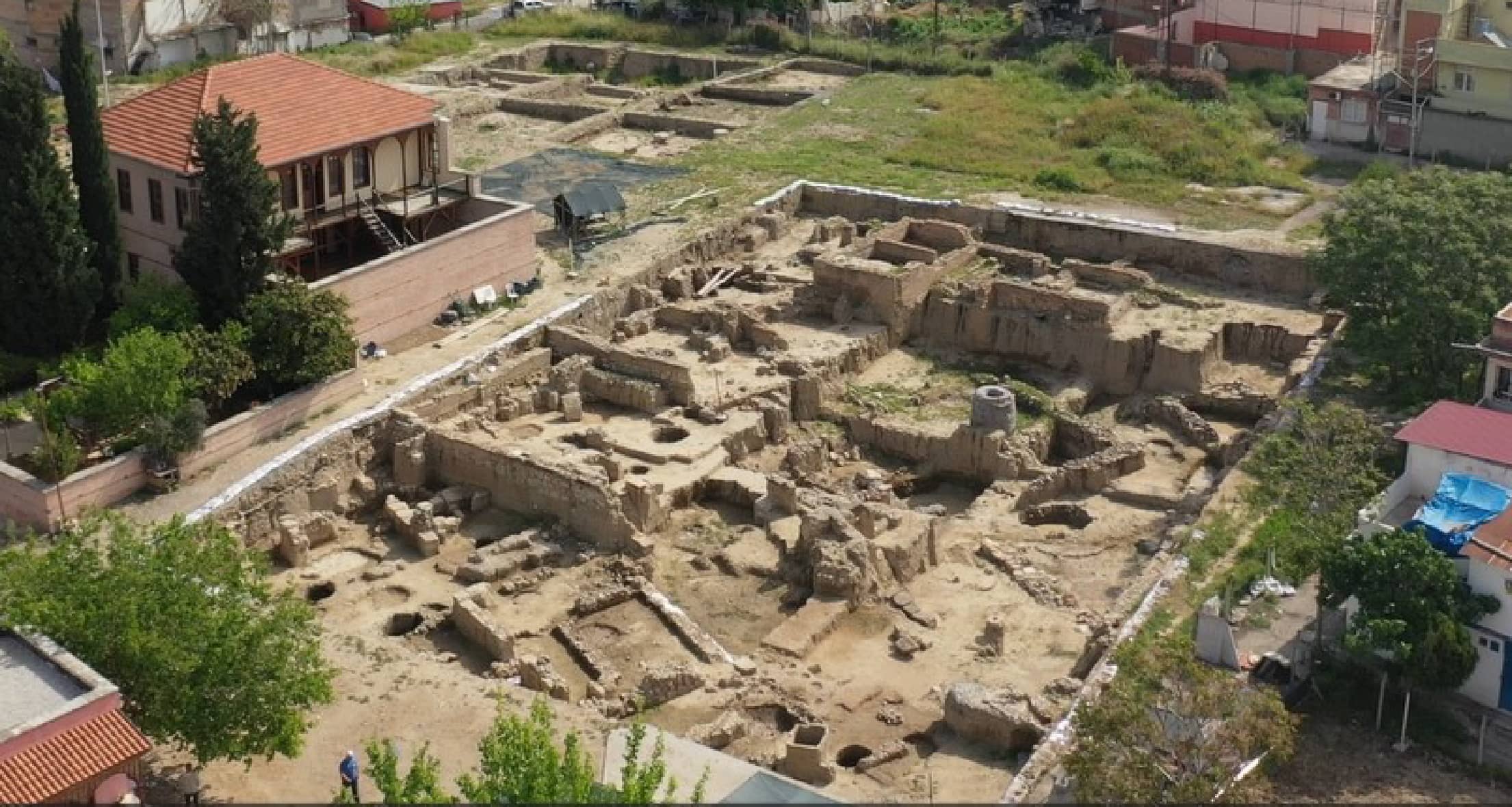
The name Adana is also found in the bilingual inscriptions of the Karatepe/Aslantaş-Azatiwata settlement, located within what is now Osmaniye province and recognized as the country's first open-air museum. The correlation between Ad/taniia and Adaniia with Adana was initially made by Olmstead. Although some scholars are cautious about this association, the strongest candidate for the localization of this name is the Tepebağ Mound in central Adana. Excavations at Tepebağ Mound, ongoing since 2013, are pivotal for understanding Adana's history and the broader archaeological context of the Mediterranean region.
You can subscribe to our newsletter to be informed via email about events near you.